REGIONS: ORIGIN SITE ~ Southeast WA, RE-LO SITES ~ Southeast WA
The movement of the Smoothing Iron Ridge Emergency Lookout (ELO) from the Blue Mountains near Anatone to a private wheat ranch in southeast Washington is an unusual Type 2 re-location as the LO cabin has actually been moved twice. None of the usual Washington lookout references mentions the moves or the fact that the cabin still exists. The entry for the Smoothing Iron Lookout in the FFLA’s firelookout.org web site, which reads “Built in 1935, this cabin was used for emergencies in the 1940 and is now gone”, is typical of the other references.
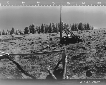
The book HISTORY OF THE NORTHERN BLUE MOUNTAINS written in 1940 by Gerald J. Tucker gives more details of the building of the Smoothing Iron LO. In part it reads ….”In 1933 there was a very extensive building program on the Asotin District [my comment~ Umatilla National Forest]. A CCC Camp of 200 men were on the District for about four months putting in about a month at Iron Springs and three months at Mt. Misery. Besides this camp there was also a small CCC crew at Long Meadows working out of their main camp at Tollgate. The following building was done by CCC in that year: ………..Smoothing Iron emergency lookout house………….put in a new [telephone] line from Wickiup Spring to Smoothing Iron emergency station.”
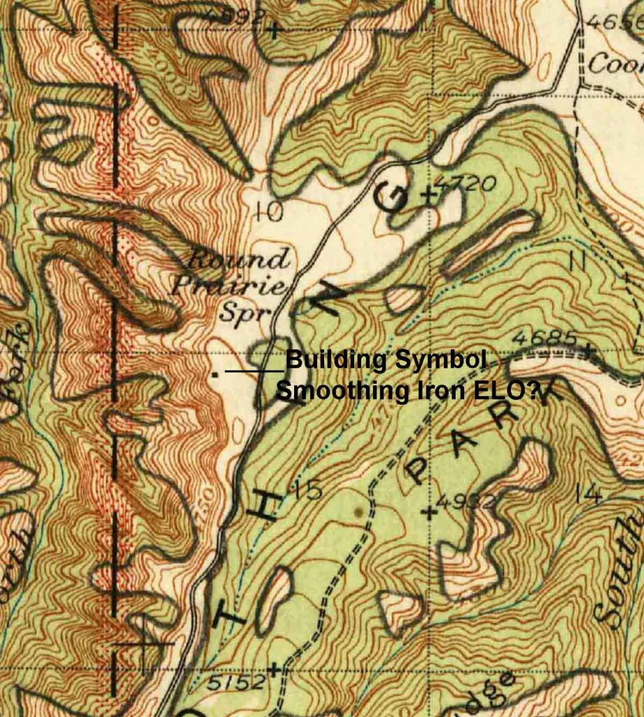
As an emergency fire lookout, Smoothing Iron was probably only staffed during times of high fire danger or after lightning storms. I have seen no information on the last date that it was used, but a 1946 USGS map shows a symbol for a building on Smoothing Iron Ridge near the northern boundary of Section 10 T8N.R43E. The 1948 Umatilla National Forest map shows the symbol for an emergency lookout in a similar location.
Research carried out in 2020 and 2021 by Rex Kamstra and Eric Willhite, two experienced Lookout Enthusiasts and expert Lookout History Investigators, indicated that the emergency lookout cabin had been acquired by a private owner and moved to a nearby farm in 1950. It was then later moved again by a second private owner and it still existed.
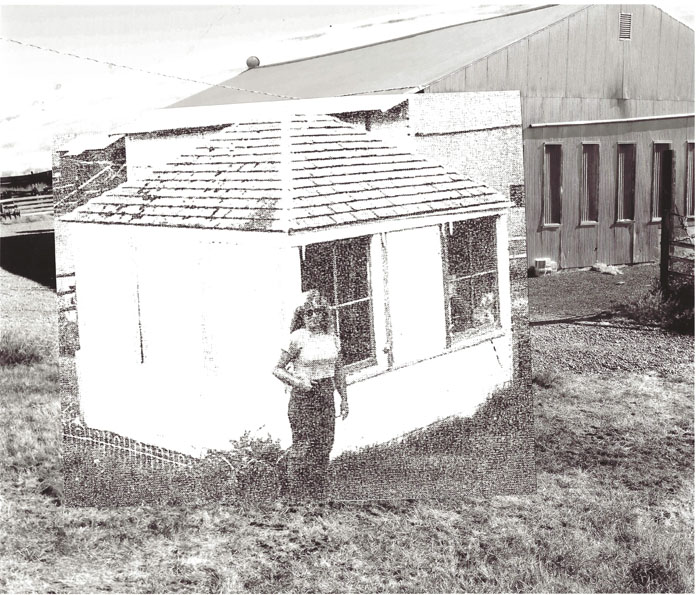
Rex discovered evidence that the ELO cabin had been moved in 1950 to a nearby farm in an unnamed document. On March 21, 2020 Rex wrote in an email to Eric ~ “Here’s some additional intel on what happened to the Smoothing Iron ELO house in Southeast Washington. It was at some point moved to a farm 4.5 miles northeast of the site.” Rex also included a copy of a photo of the re-located ELO cabin which he said came out of another document, possibly a FS publication.
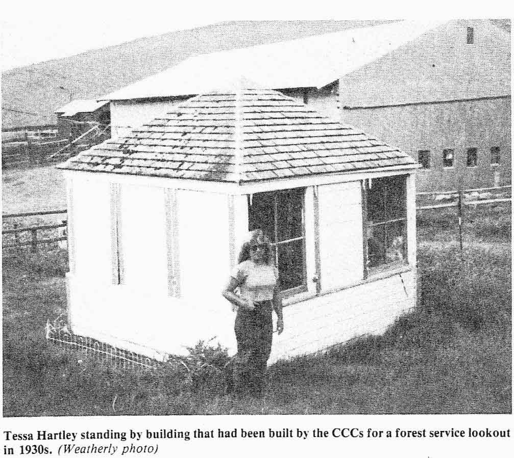
In a follow-up email addressed to both Eric and me, Rex included additional info from the unnamed document: “The tour continued by the old fallen down, log corrals on Round Prairie and made a stop just beyond where the Forest Service fire lookout cabin had stood (the cabin is now in the Schlee lawn area, moved by Steve Black in 1950)………The Sixth Historical and Sight-Seeing Tour was sponsored by the Asotin County Historical Society and was led by Bob Weatherly.”
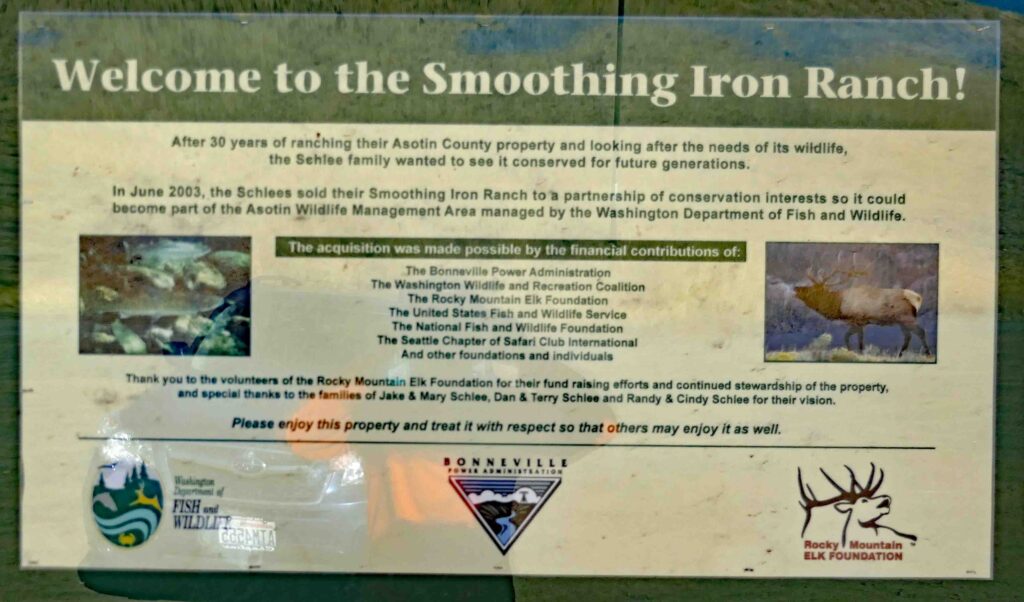
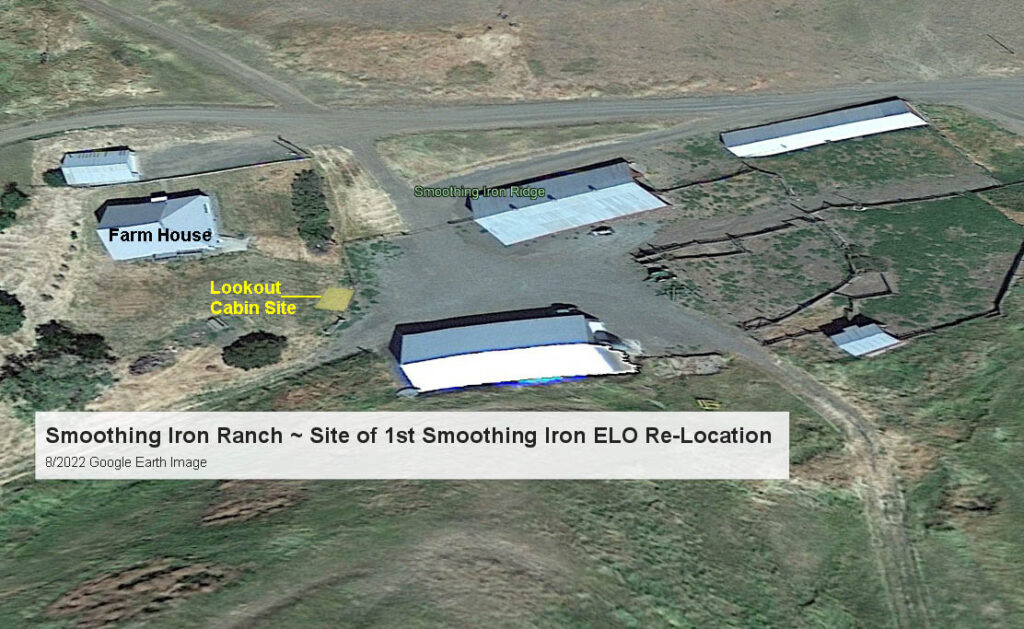
Research continued to try to determine if the cabin had been destroyed or if it was again moved. If it still existed, where was it? The ranch changed hands several times after Black first moved the lookout cabin. The 8,500-acre ranch now belongs to the Washington Department of Fish and Wildlife (WDFW). It was purchased in July, 2003 with funds from the Bonneville Power Administration, the state of Washington and the Rocky Mountain Elk Foundation. The previous owning family retained the right to farm part of the ranch for five years. In 2009 they informed the WDFW that they were no longer interested in raising wheat on Smoothing Iron Ridge.
Eric Willhite then “poked around on the internet and hit the jackpot”. He was able find contact information and to talk on the phone with one of the members of the family who had sold the Smoothing Iron Ranch to the WDFW. He was told that the lookout cabin still existed and was owned by his brother. They had moved it to one of the other family farms in Southeast Washington. He told Eric that they moved it because it was in the way but wasn’t sure why they kept the structure in the family other than “it was just an interesting building”.
The First Move of the Smoothing Iron Emergency Lookout Cabin to the Nearby Private Black Ranch
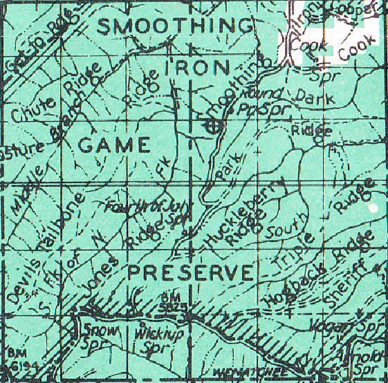
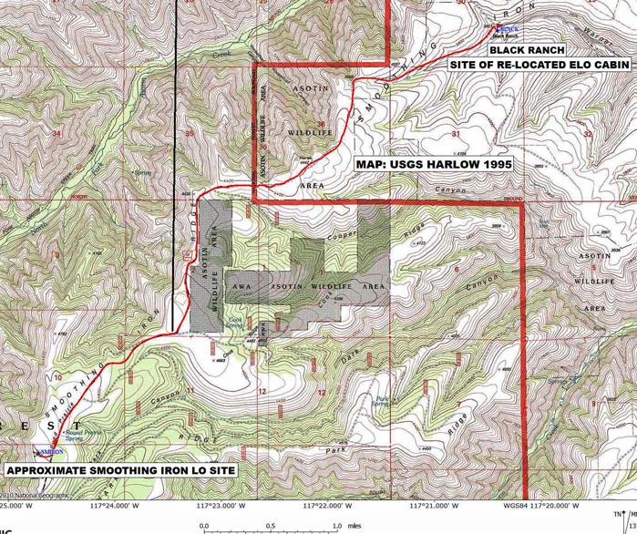
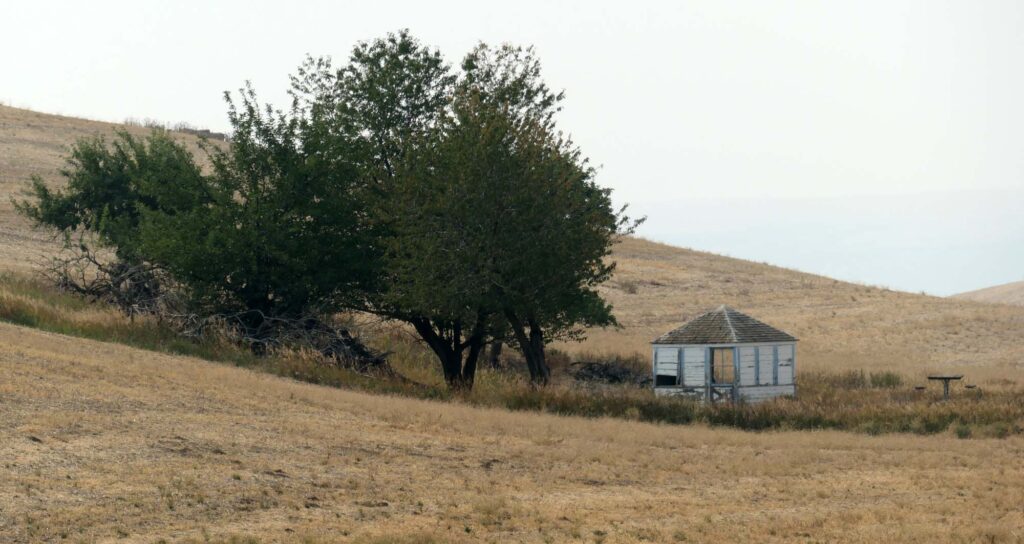
The tour report above and other evidence indicates that the lookout was near the Round Prairie Springs. The maps above shows the Round Prairie Springs near the building symbols. Some maps of the area show both the springs and a farm to the northeast of them labelled Black Ranch. The distance by road between these two, shown on the map below closely matches the 4.5 miles quoted above.
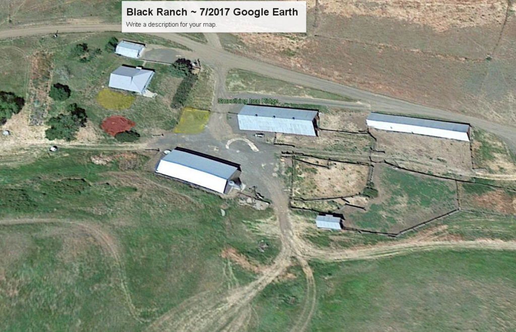
We could not see the Re-Located Lookout on a July, 2017 Google Earth (GE) image. It seemed likely that the Lookout cabin no longer was on its re-located site on the farm. There were several spots seen in the image that would fit the description as being “the cabin is now in the lawn area.”
Our Visit to the Black Ranch~ the 1st RE-LO SITE for the Smoothing Iron Ridge ELO
We had planned to visit the Black Ranch, now known as the Smoothing Iron Ranch in early September, 2021 on the same trip as our visit to the current location of the re-located Smoothing Iron Ridge ELO. We knew that the roads into the area had been closed earlier due to two Forest Fires in the Blue Mountains and Asotin Creek area. We stopped at the Clarkston office of the WDFW on September 7 to check on the status of the roads and of the farm buildings. A WDFW employee verified that the roads were still closed due to the ongoing Green Ridge Fire and damage caused by the earlier Lick Creek Fire. He also told us that some of the farm lands had been burnt by the Lick Creek Fire, but the farm buildings were still there. Our visit would have to wait for another year.
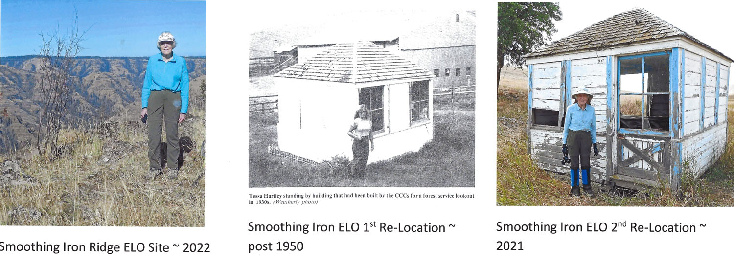
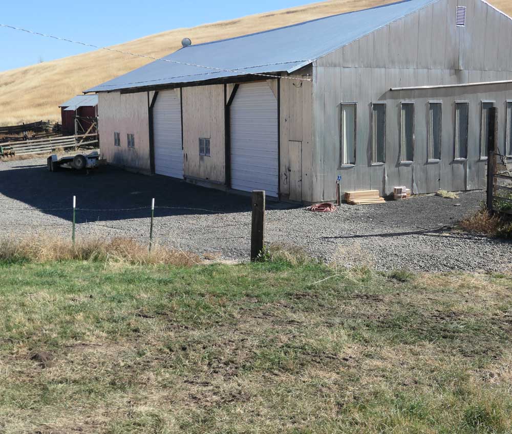
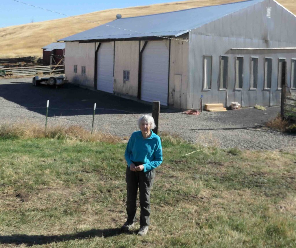
We returned to visit both the Smoothing Iron Ridge ELO Site and the Black Ranch on October 17, 2022. After visiting the ELO site, we drove the 4.5 miles to the farm buildings on the Black Ranch (Now called the Smoothing Iron Ranch or the Schlee Ranch by the WDFW).
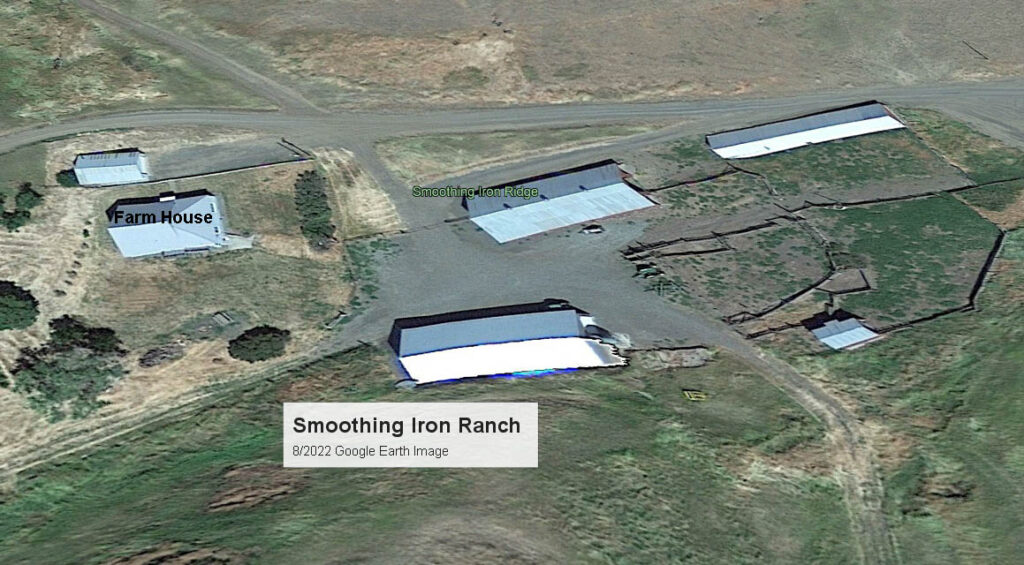
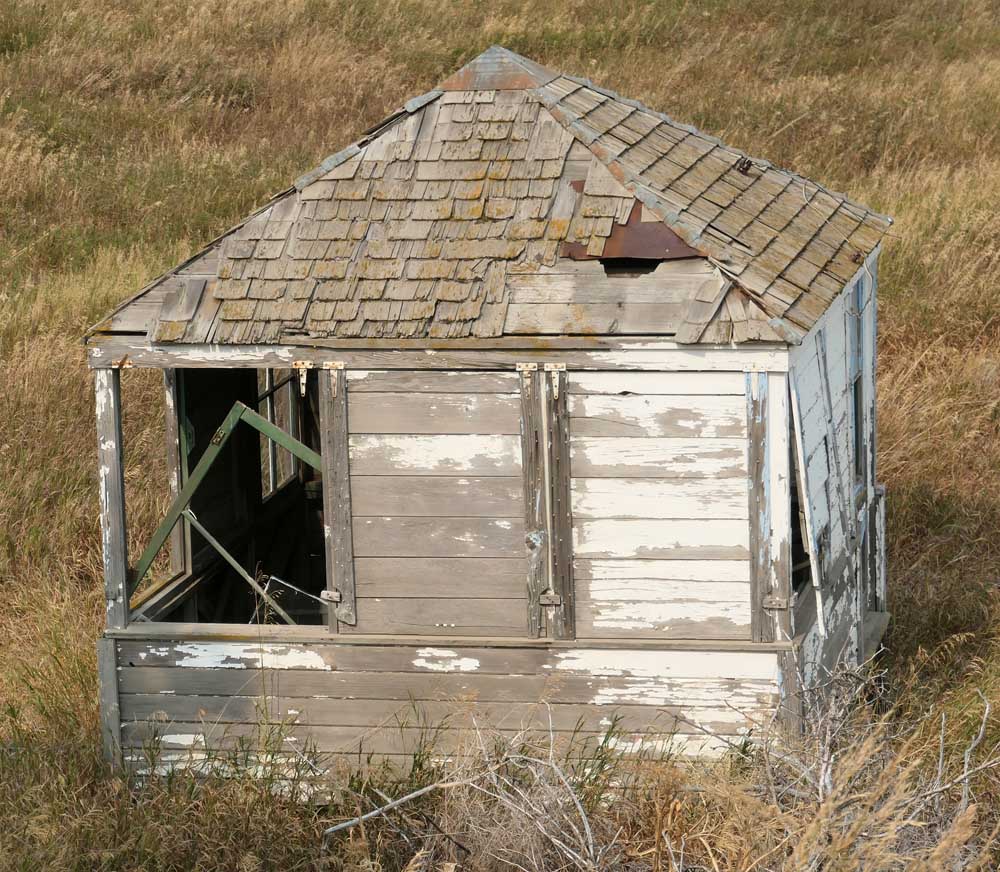
The farm house was no longer occupied, but we were able to walk down onto the lawn area to check out where the ELO cabin had been. The farm buildings matched the older Weatherly photo (the windows on the big shed had been modified).
The Second Move of the Smoothing Iron Emergency Lookout Cabin//
Eric Willhite then “poked around on the internet and hit the jackpot”. He was able find contact information and to talk on the phone with one of the members of the family who had sold the Smoothing Iron Ranch to the WDFW. He was told that the lookout cabin still existed and was owned by his brother. They had moved it to one of the other family farms in Southeast Washington. He told Eric that they moved it because it was in the way but wasn’t sure why they kept the structure in the family other than “it was just an interesting building”.
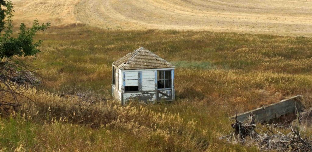
In 2003, the owner of the Smoothing Iron Ridge ELO moved it from the Smoothing Iron Farm to another of their wheat farms in SE Washington.
Our Visit to the Private SE Washington Wheat Farm ~ the 2nd RE-LO SITE for the Smoothing Iron Ridge LO
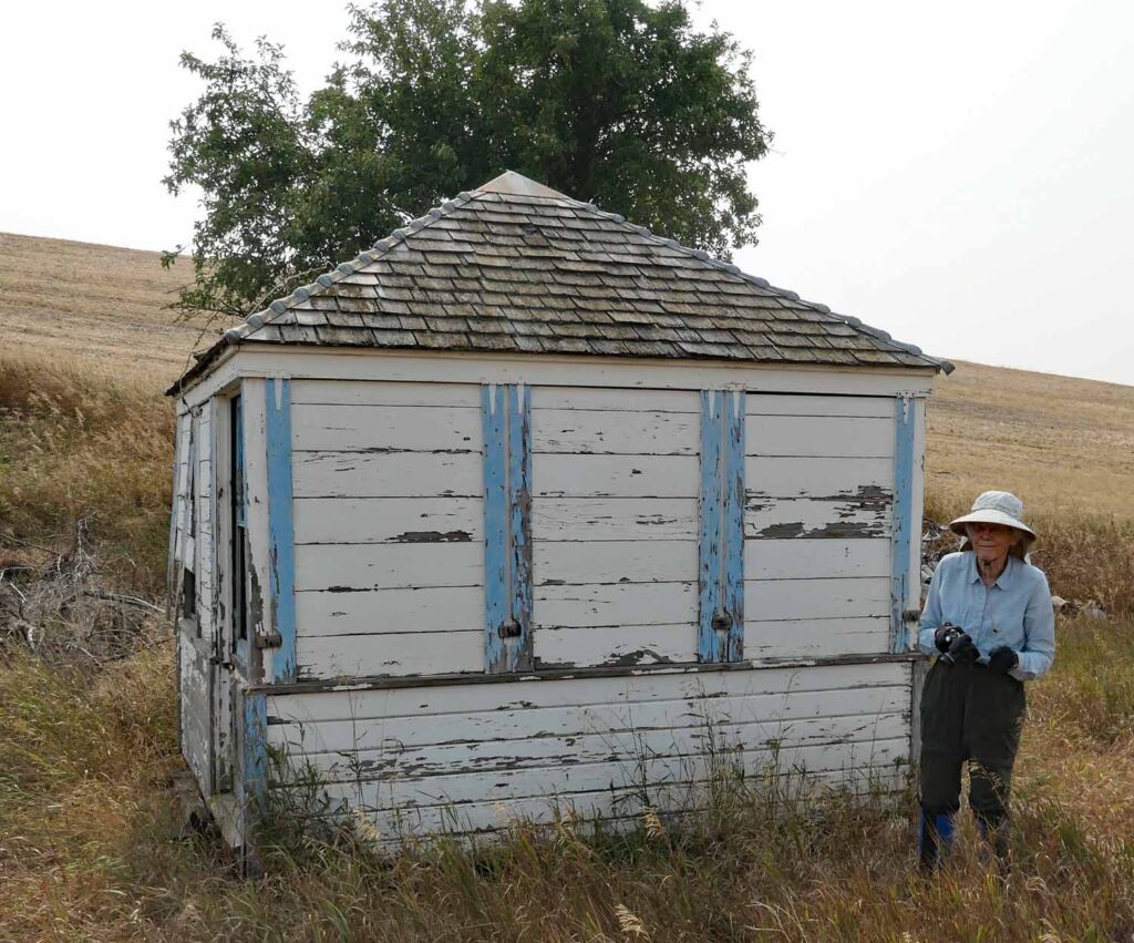
I called the owner of the cabin as Peggy and I were planning a 3 week lookout chasing visit to Central and Eastern Washington in summer/fall of 2021. He told me that the cabin was on the Smoothing Iron Ranch when they bought it. It was in good shape and they had used it for storing lawn mowers and other equipment. When they sold the ranch to WDFW in 2003, they decided to move the cabin to one of their other ranches as it was still in good shape and he figured that the WDFW would just burn the cabin if they left it. He had worked on the farm that the cabin is now on for 25 years, but he was now retired. Since neither brother knew the background of the cabin and its use as a fire lookout, I sent them the information and photos that I had about it. When we asked for permission to visit and photograph the ELO cabin, he said that his brother who still worked and managed the farm should also be asked for permission to visit the farm. After we talked to both brothers, they both gave us permission to visit and photograph the cabin and provided directions to the cabin.
Peggy and I visited the Re-Located Smoothing Iron Ridge Emergency Lookout Cabin on September 9, 2021. It now sits on a grassy old homestead area on one of the family’s farms. We walked gated private farm roads to reach it. The visit can be made only by invitation of the owners.
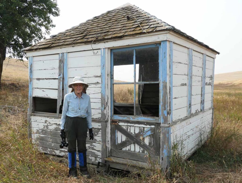
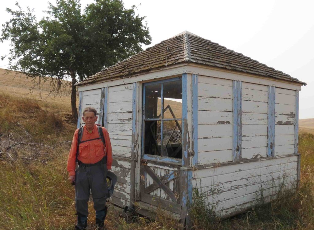
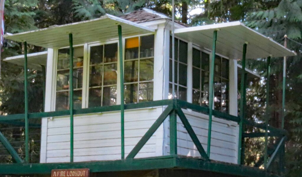
The Smoothing Iron LO cabin was similar to the L-6 lookout cab with 3 windows per side and a four-sided hip roof. The shutters differed from Ray Kresek’s L-6 LO as it had a separate shutter for each window, while Ray’s LO had a single shutter for the three windows.
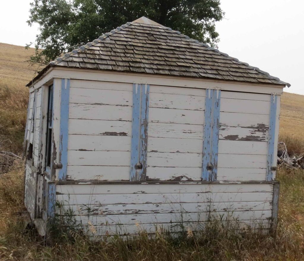
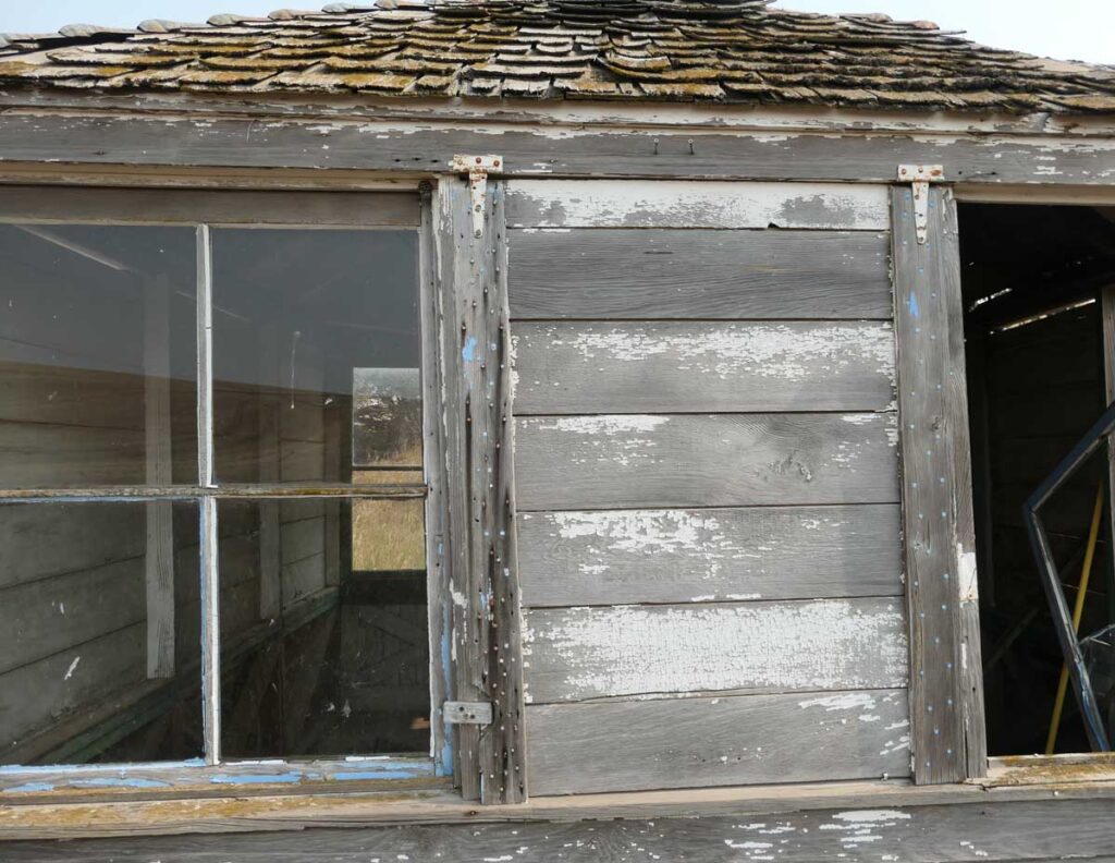
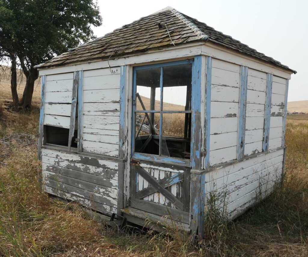
The Smoothing Iron Ridge ELO Cabin could use some Tender Loving Care ~ 2021 photo
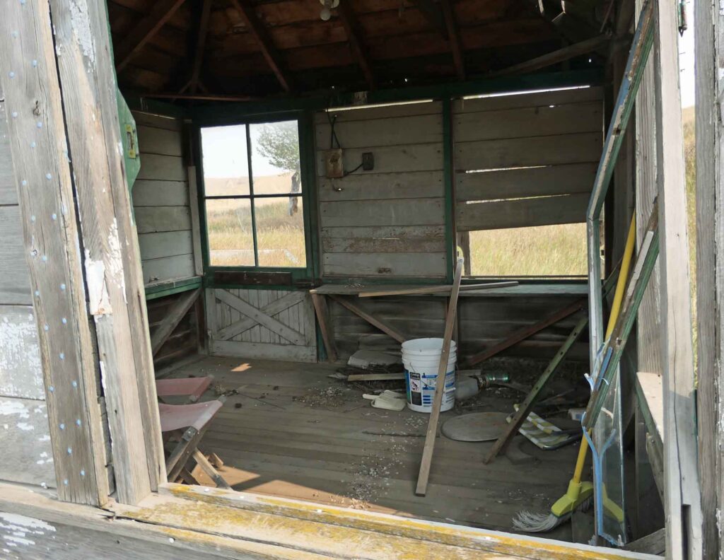
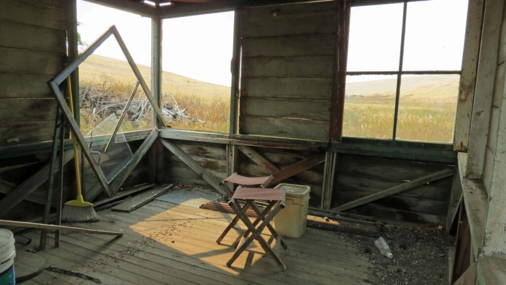
The broom had not been used for some time ~ 2021 photos
Our Visit to the Smoothing Iron Ridge ELO Site ~ 10/17/2022
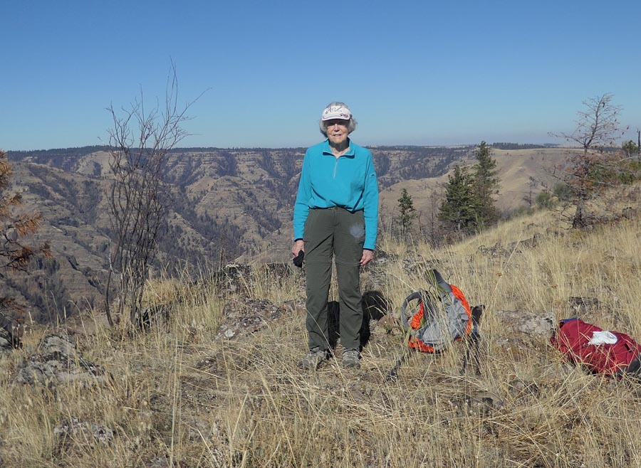
Peggy and I drove to visit the Smoothing Iron Ridge on October 17, 2022. This was our second attempt to visit the ridge and to look for any remains or signs that might remain there of the re-located Smoothing Iron Emergency Lookout (ELO). Out first attempt to drive to the ridge in September, 2021 was unsuccessful as we found the roads to it were closed due to the ongoing Green Ridge Fire and road damage caused by the earlier Lick Creek Fire.
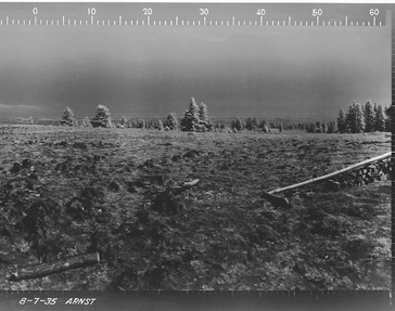
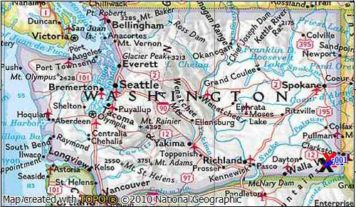
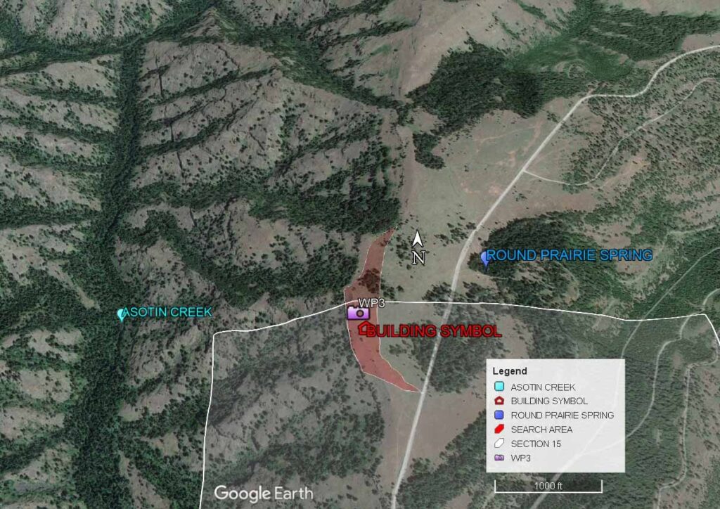
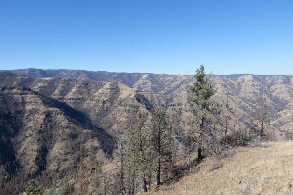
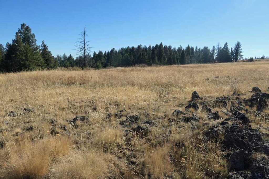
The Smoothing Iron Ridge is located in the Southeast Washington’s Blue Mountains 20 miles southwest of Asotin. The flat ridge top, with an average elevation of 5000’ extends 4 ½ miles to the northeast from near Round Prairie Springs. The land along the west and north sides of the ridge drops steeply into Asotin Creek’s Fork which flows over 2000 ft below. On three surrounding sides the land forms are characterized as lightly forested, steep sided, sharp ridges with deeply cut stream gorges. There is high farm land and wheat ranches on a big flat plateau to the east. In 1933 the CCC built an emergency lookout (ELO) cabin on Smoothing Iron Ridge and put a telephone line to it from Wickiup Spring. The Smoothing Iron Ridge ELO was reported to be near the Round Prairie Spring.
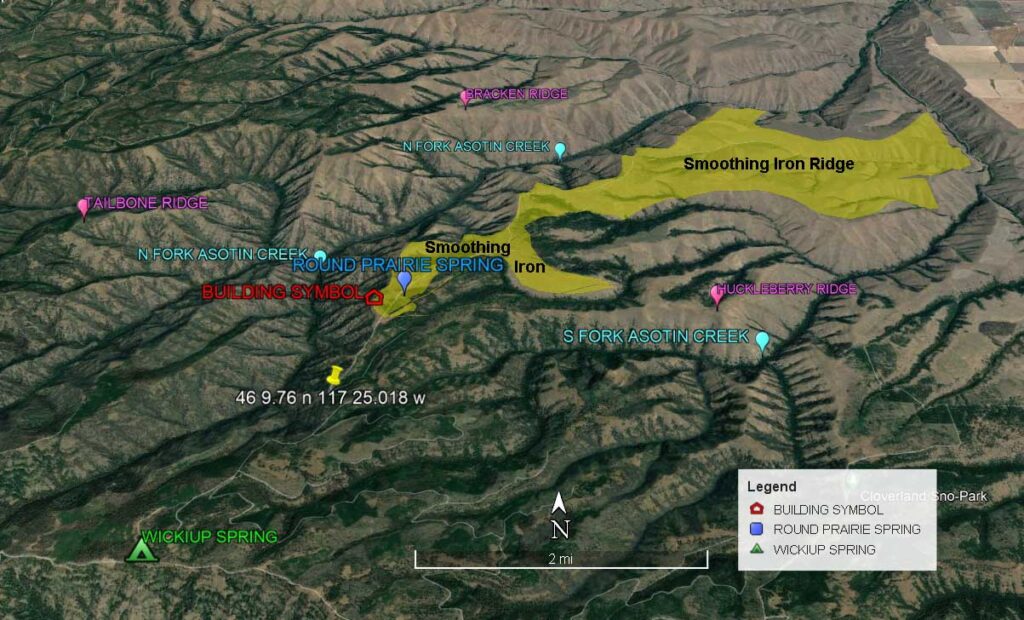
When we began to make our plan to visit the abandoned lookout site, we learned of two maps which suggested a location in Section 15 T8N,R43E just south of the line dividing Sections 15 and 10. This was close to the Section 10 location given in other references. One of these maps, a 1946 USGS map, showed a building symbol. The other map, a 1948 Umatilla National Forest Map showed a symbol representing an emergency lookout at a similar location. The USGS map was detailed enough to allow estimating the coordinates of the building location. When I used these estimated coordinates to place a building symbol on an aerial photo it showed the location to be near the edge of the steep drop-off into the Asotin Creek gorge.

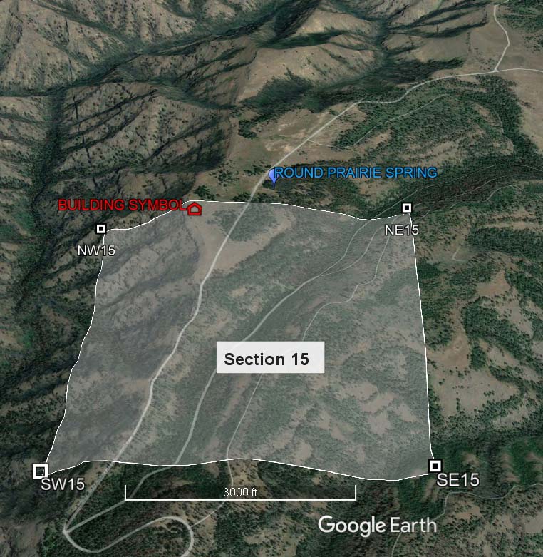
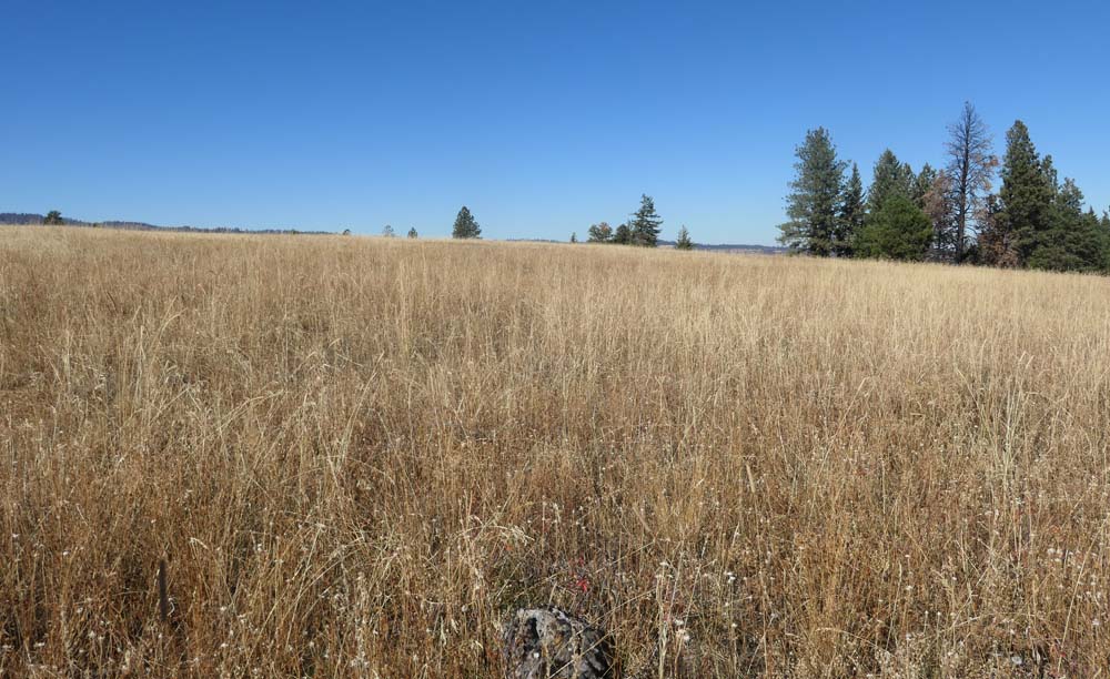
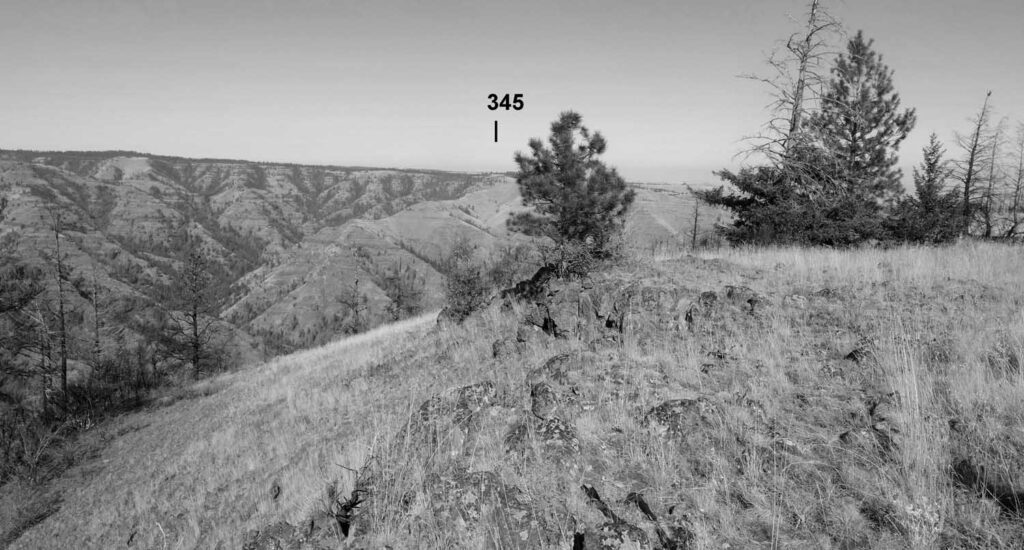
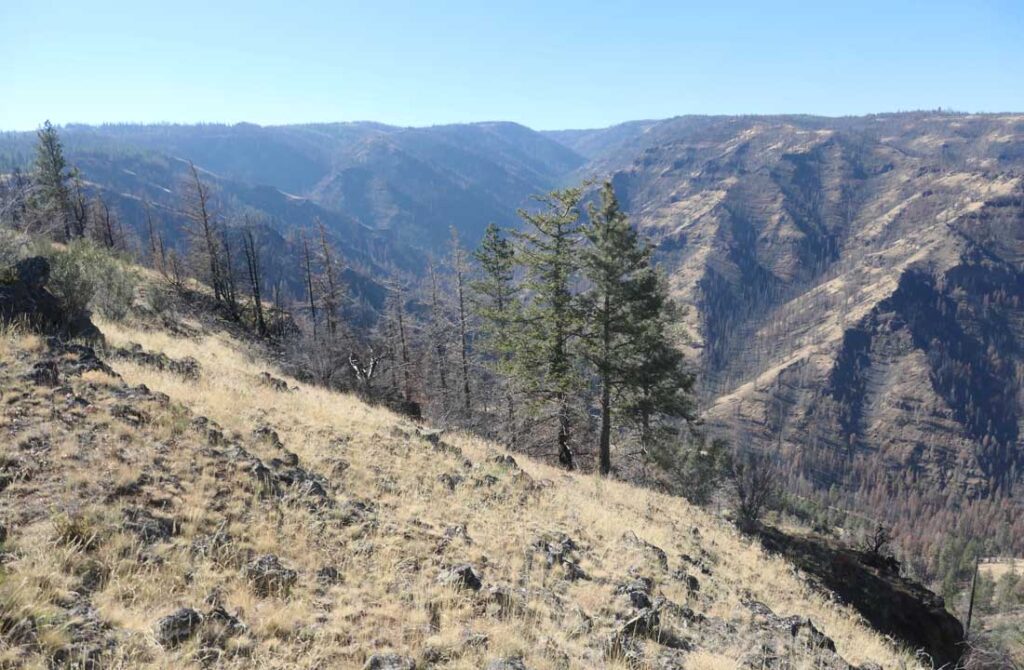
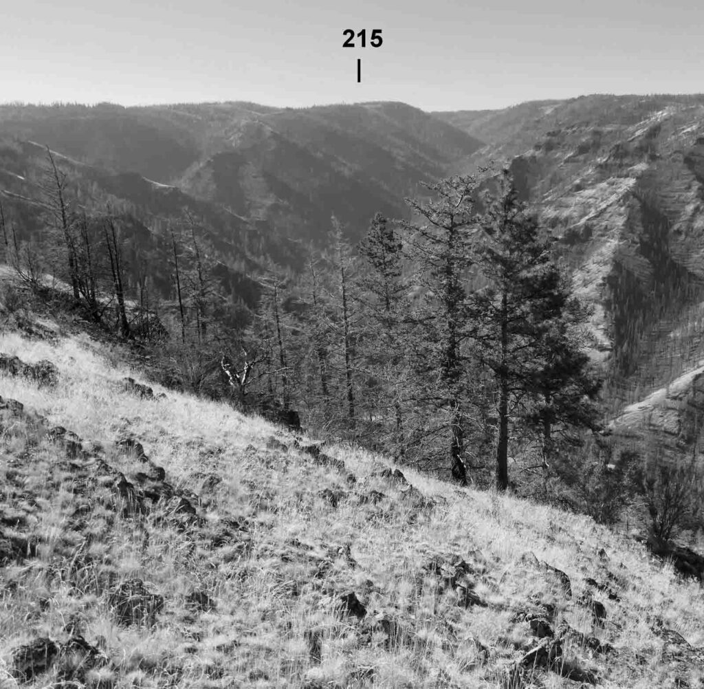
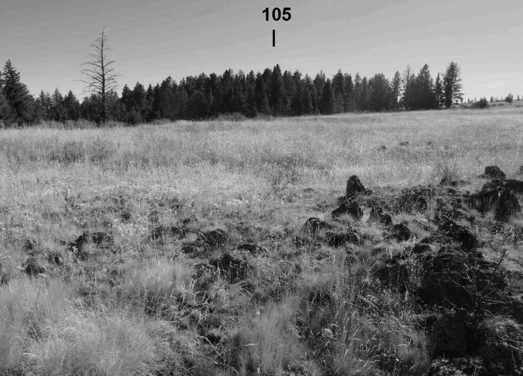
When we drove to the Smoothing Iron Ridge in 2022, we parked our car near the lookout location and used a GPS to guide us to the estimated BUILDING SYMBOL coordinates. I knew that several other “lookout fanatics” had earlier attempted to find any relics or other signs of the abandoned ELO site and had little or no success. As Eric Willhite reported on his web site “The ground vegetation made it difficult to find anything unless you are right on top of it. Several depressions were suspicious but nothing of certainty was found. “ When we reached the BUILDING SYMBOL location, we also found that the deep grass and vegetation made seeing anything left on the ground difficult. The grass and vegetation was taller and more abundant than it appeared to be on Eric’s June, 2016 visit.
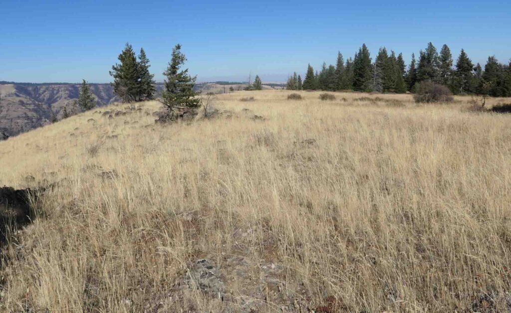
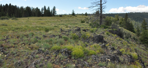
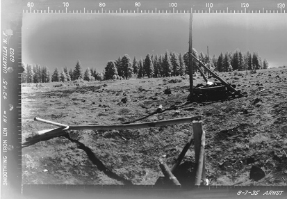
A second method used in the attempt to pin-point the exact location of the ELO cabin was to take compass readings of several prominent points around us and compare the view with the view seen on the 1935 panoramic lookout photos taken at the Smoothing Iron Lookout House. We could not see down into the Asotin Creek canyon from the estimated BUILDING SYMBOL location, while the panoramic views to the west and southwest showed much of the canyon. We moved about 100 feet west to the edge of the drop-off to the canyon and checked the views with the panoramics at a number of locations to the north and south of there along the drop-off line (The area of this search is shown in red on the image below). We also took photographs at each of these locations.
Comparison of our photos taken in four different directions at a likely ELO location to a similar view from the 1935 panoramic photos are shown below. ( In each case, one of our photos is shown in color. Below this is shown a cropped and converted to black and white version of this is compared to a similarly cropped image from one of the 1935 panoramic photos.)
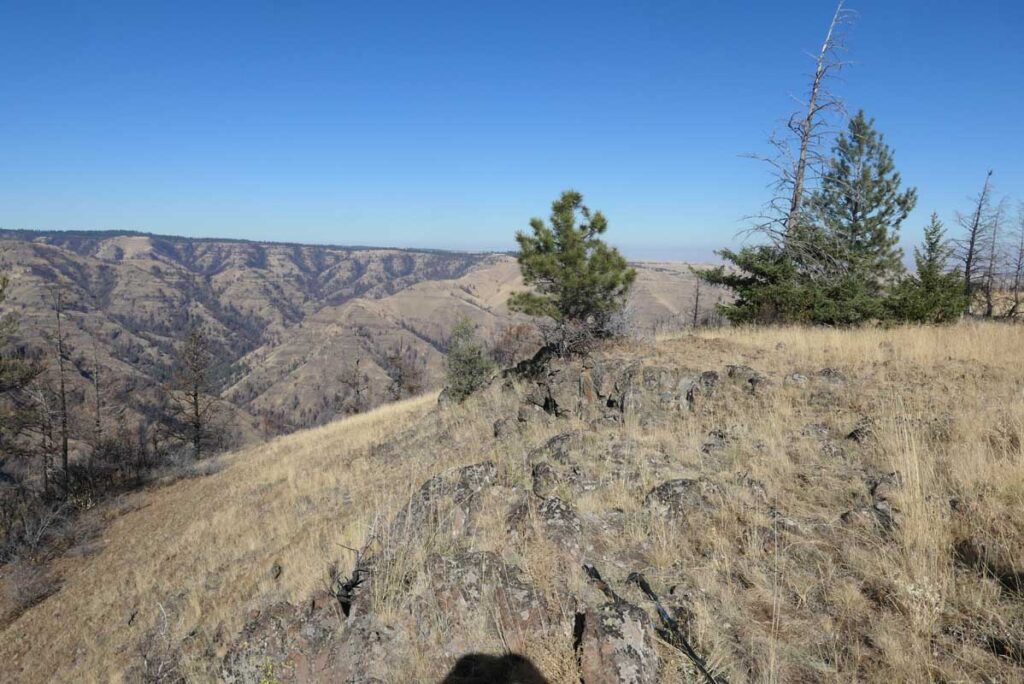
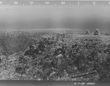
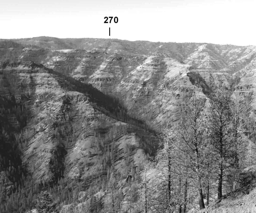
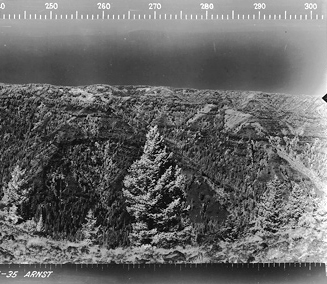
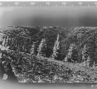
These comparisons indicated that we had been to the original site of the Smoothing Iron Emergency Lookout. However , like other Lookout Fanatics”, we were unable to find any foundations or other lookout artifacts.
After we returned home, I published a preliminary report about our visit. An email then arrived from Charlie and Bev Heebner describing their visits to the Smoothing Iron site and the remains that they had seen. The Heebners did not say when their visits were made, but I knnow that they staffed the nearby Oregon Butte Lookout for 14 summers. An article in the August 2004 FFLA Lookout read in part “Oregon Butte Open Next Summer. After fourteen summers on Oregon Butte, Bev and Charlie Heebner have decided to do something other than staff a hike-in lookout. So, next year, the Oregon Butte lookout position will be open!” Oregon Butte and the Smoothing Iron Ridge are both in the Umatilla National Forest’s Pomeroy Ranger District.
The November 24, 2022 email read: “Bev and I have been to the lookout site on Smoothing Iron site several times. It is pretty much as described and the location is as shown on the shaded portion of Ralph’s map. It is right on the edge of the canyon to the west. Today is Thanksgiving. We are not at home and all of my maps are, so I can’t provide much about names, places and Locations.
Stories pertaining to the lookout being moved, once to the Fish and Wildlife facility off of Smoothing Iron Ridge and then again to a farm some place in southeast Washington, are the same as I remember. I never went looking for the lookout somewhere up on the Palouse up towards Moscow, Idaho because I had no clue where to begin looking. It is a big area.
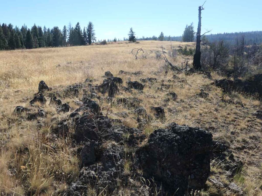
As I remember there was some stonework, maybe a fence defining a yard-like area. Over the edge of the cliff were the remains of what looked like the shape of the metal strapping that is used to bind wooden shingles or shakes for shipping . Also, I may recall a bunch of open and rusted food cans. There were miscellaneous scraps, chunks or pieces of phone wire and some pieces of old and weathered lumber. Directly to the east was a little wooded area that looked like it had a phone line sometime in the past. In the unwooded area along the road there were, I think, stone piles that supported the poles that carried the phone line.
Charlie and Bev Heebner”
The railings, telephone post and wooded area to the east shown on two of the 1935 panoramic images matches some of the Heebner’s description.